The Yukon/Arctic Expedition 2017

The Yukon River as it crosses the NW part of North America
This goal of this expedition is to float the Yukon River in its entirety from just below the Whitehorse Dam in Whitehorse, Yukon Territories to the Bering Sea where it empties out through the vast treeless Yukon-Kuskokwim Delta. This is mostly a wilderness and cultural experience trip, floating through some of the most stunning of Alaskan and Northern Canadian landscapes and visiting many historic gold mining towns and remote rural subsistence villages along the way. We will travel along the river 1800 miles more or less depending upon which channels we ultimately take and as we loop up above the Arctic Circle we expect to experience about 10 days without a sunset. We are gearing up for freezing weather, temps above 90 degrees, thunderstorms, constant drizzle, wind, waves, clouds of mosquitoes, and many days with all the above on the same day.
The river can be divided into 3 separate sections, the upper Canadian and historic gold rush section, the middle Yukon Flats section with its wide banks and multiple false channels, and the lower river featuring the string of Native American villages from Athabaskan in the north to Yupik Eskimo near the Delta. Before we start we will first be trailering our ship from Jeff’s base camp in Seymour Texas over 3000 miles to the launch site in Whitehorse. From Texas we’ll cross into Oklahoma, Colorado, Wyoming, Montana, then into Canada and the provinces of Alberta, British Colombia, and the Yukon Territories.

Road trip from Seymour Texas to Whitehorse Yukon Territories.
Our plan is to launch on May 29th at the Robert Service Campground in Whitehorse spending a couple days rigging the boat and finally pushing off the bank on June 1st. The first 550 river miles are in Canada and will follow the path of the Klonkide gold rush stampeders of 1896 through Carmacks, the abandoned town of Fort Selkirk, and on to Dawson City which at one point had a population of over 40,000 although now it has fewer that 1500 residents. Along the way we will have to navigate the 5 Fingers Rapids and the Rink Rapids and pass through Lake Labarge.
One hundred miles beyond Dawson City lies the Alaska border and the towns of Eagle and Circle and the beginning of the Yukon Flats. For the next 400 miles we will need to pay close attention to the multiple channels, gravel bars, floating logs, and thunderstorms as we navigate with satellite photos and try to pick the best channel to take the boat through. This area is where temperatures of over 100 degrees have been recorded late in the summer and where the wind and weather can quickly change and turn rough. In the Yukon Flats the river can be up to 3 miles wide with over 10 different channels separated by islands up to 300 acres in area. Here we will resupply in Fort Yukon, Beaver, and Stevens Village.

Yukon Flats near Beaver, Alaska. The river is 2 miles wide here.
About halfway through the trip we will pass under the second and last bridge across the Yukon River at the Dalton Highway and Alaska Pipeline crossing where we will resupply and prepare for the trip down the lower river. Passing by and stopping in the over 20 native villages and seasonal fish camps along the river we will be a part of the lifestyle of subsistence fishers and hunters that have existed along the river for thousands of years. Here the river is the transportation corridor in both summer and winter and boat and barge traffic will increase as the summer fully arrives in July. We pass through the villages of Ruby, Galena, Kaltag, Anvik, and Holy Cross as we ride the meandering river towards the treeless delta. The last 300 miles will be windy and rough as we approach the Bering Sea and enter the Yupik Eskimo territory. Here the river swells again in size to between one and one and a half miles wide, becomes tidal, and we will struggle to make headway into the prevailing winds. Fifteen miles from the sea is the village of Emmonak and the regional hub for this coastal area. Here, after a run out to sea and back we will sell our boat and gear to hop a flight back to Anchorage where the possibility of a warm shower and real bed temp us and we'll wrap up this trip with a toast to our good fortune!
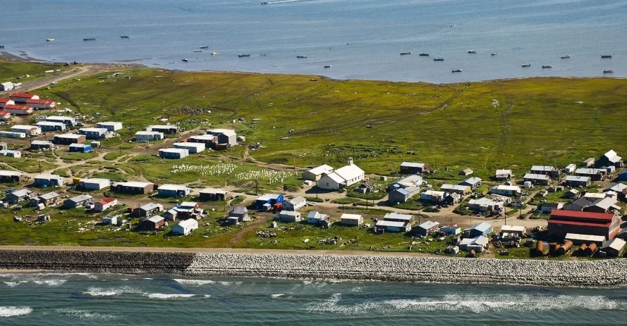
Coastal Inuit village in Alaska.